|
Unionoida | Unionoidea | Unionidae | Ambleminae | Lampsilini | Lampsilis species Lampsilis floridensis (Lea, 1852): specimens
1 nominal species
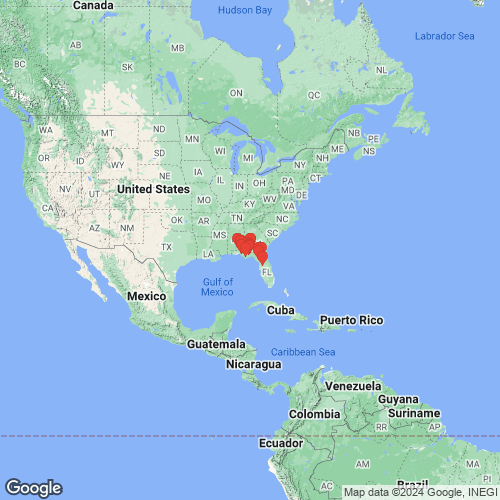
Range: In the eastern Gulf Coastal Plain, from the Escambia east into peninsular Florida, USA. Map of Georeferenced Specimens
 |
Genbank Vouchers
USAUF_438578 (LfloSuw070) (COI, ND1, ITS1, 5.8S) Santa Fe River on State Hwy 121, S of Worthington Springs (29.92199, -82.42658) JFBM_22437_1 (SK16073) (COI, ND1, ITS1, 5.8S) Flint River at SR 37 Boat Landing in Newton, Baker/Mitchell Co. GA (31.30919, -84.33491) JFBM_22437_2 (SK16074) (COI, ND1, ITS1, 5.8S) Flint River at SR 37 Boat Landing in Newton, Baker/Mitchell Co. GA (31.30919, -84.33491) UF_438578 (LfloSuw063) (COI, ND1) Santa Fe River on State Hwy 121, S of Worthington Springs (29.92199, -82.42658) UF_438578 (LfloSuw069) (COI, ND1) Santa Fe River on State Hwy 121, S of Worthington Springs (29.92199, -82.42658) UF_438578 (LfloSuw064) (COI, ND1) Santa Fe River on State Hwy 121, S of Worthington Springs (29.92199, -82.42658) JFBM_22437_9 (SK16081) (COI, ND1) Flint River at SR 37 Boat Landing in Newton, Baker/Mitchell Co. GA (31.30919, -84.33491) JFBM_22437_6 (SK16078) (COI, ND1) Flint River at SR 37 Boat Landing in Newton, Baker/Mitchell Co. GA (31.30919, -84.33491) UF_438578 (LfloSuw067) (COI, ND1) Santa Fe River on State Hwy 121, S of Worthington Springs (29.92199, -82.42658) JFBM_22437_5 (SK16077) (COI, ND1) Flint River at SR 37 Boat Landing in Newton, Baker/Mitchell Co. GA (31.30919, -84.33491) JFBM_22437_10 (SK16082) (COI, ND1) Flint River at SR 37 Boat Landing in Newton, Baker/Mitchell Co. GA (31.30919, -84.33491) UF_438578 (LfloSuw071) (COI, ND1) Santa Fe River on State Hwy 121, S of Worthington Springs (29.92199, -82.42658) JFBM_22437_3 (SK16075) (COI, ND1) Flint River at SR 37 Boat Landing in Newton, Baker/Mitchell Co. GA (31.30919, -84.33491) UF_438578 (LfloSuw065) (COI, ND1) Santa Fe River on State Hwy 121, S of Worthington Springs (29.92199, -82.42658) UF_438578 (LfloSuw066) (COI, ND1) Santa Fe River on State Hwy 121, S of Worthington Springs (29.92199, -82.42658) UF_438578 (LfloSuw068) (COI, ND1) Santa Fe River on State Hwy 121, S of Worthington Springs (29.92199, -82.42658) JFBM_22437_4 (SK16076) (COI, ND1) Flint River at SR 37 Boat Landing in Newton, Baker/Mitchell Co. GA (31.30919, -84.33491) UF_438454 (LfloSuw022) (COI, ND1) Boat basin off Suwannee River in Original Suwannee River Campground @ 1 mi. W of Fanning Springs (29.58891, -82.94239) JFBM_22437_7 (SK16079) (COI, ND1) Flint River at SR 37 Boat Landing in Newton, Baker/Mitchell Co. GA (31.30919, -84.33491) UF_438535 (LfloCho016) (COI) Choctawhatchee River ~1.5 miles upstream of FL Hwy 20 bridge; sample taken in bend of river below mouth of slough on RDB (30.47335, -85.88662) UF_441067 (LfloCho057) (COI) Pea River at confluence of Choctawhatchee River in Geneva (31.02185, -85.85833) UF_441067 (LfloCho058) (COI) Pea River at confluence of Choctawhatchee River in Geneva (31.02185, -85.85833) UF_438346 (LfloOch044) (COI) Ochlockonee River about 150 m upstream of US 90 bridge (30.47529, -84.40481) UF_441067 (LfloCho056) (COI) Pea River at confluence of Choctawhatchee River in Geneva (31.02185, -85.85833) UF_438733 (LfloFli007) (COI) Flint River on GA Highway 37, south side of Newton (31.306961, -84.338597) UF_438346 (LfloOch042) (COI) Ochlockonee River about 150 m upstream of US 90 bridge (30.47529, -84.40481) UF_441067 (LfloCho060) (COI) Pea River at confluence of Choctawhatchee River in Geneva (31.02185, -85.85833) UF_439011 (LfloOch076) (COI) Ochlockonee River at mouth of High Hill Creek, about 2 km below mouth of Telogia Creek (30.25497, -84.72145) UF_438739 (LfloCho012) (COI) Slough on south side of Cowford Lake off Choctawhatchee River below Hwy 20 bridge (30.4321, -85.9103) UF_438346 (LfloOch047) (COI) Ochlockonee River about 150 m upstream of US 90 bridge (30.47529, -84.40481) UF_441028 (LfloOch055) (COI) Ochlockonee River about 4.0 RM downstream of Jackson Bluff Dam (30.36034, -84.68476) UF_438733 (LfloFli010) (COI) Flint River on GA Highway 37, south side of Newton (31.306961, -84.338597) UF_439370 (LterEsc141) (COI) Point A Lake near large island. Mussels collected during draw down (31.37259, -86.517135) UF_438344 (LfloCho021) (COI) Pea River on AL Hwy 87 just N of the FL state line (30.99735, -85.99712) UF_438510 (LfloCho049) (COI) Cowford Lake off Choctawhatchee River, below FL Hwy 20 bridge (30.43643, -85.9012) UF_438346 (LfloOch048) (COI) Ochlockonee River about 150 m upstream of US 90 bridge (30.47529, -84.40481) UF_438346 (LfloOch045) (COI) Ochlockonee River about 150 m upstream of US 90 bridge (30.47529, -84.40481) UF_439370 (LterEsc142) (COI) Point A Lake near large island. Mussels collected during draw down (31.37259, -86.517135) UF_439370 (LterEsc148) (COI) Point A Lake near large island. Mussels collected during draw down (31.37259, -86.517135) UF_438346 (LfloOch043) (COI) Ochlockonee River about 150 m upstream of US 90 bridge (30.47529, -84.40481) UF_439370 (LterEsc146) (COI) Point A Lake near large island. Mussels collected during draw down (31.37259, -86.517135) UF_438768 (LfloOch005) (COI) Ochlockonee River, 1 air mile upstream of US Highway 27 bridge - river access gained through SBA communication combination lock 4722 (30.56719, -84.37989) UF_439370 (LterEsc145) (COI) Point A Lake near large island. Mussels collected during draw down (31.37259, -86.517135) UF_438335 (LfloOch040) (COI) Lake Talquin about 3.9 km SSE of Midway (30.4607, -84.44583) UF_441067 (LfloCho062) (COI) Pea River at confluence of Choctawhatchee River in Geneva (31.02185, -85.85833) UF_439011 (LfloOch077) (COI) Ochlockonee River at mouth of High Hill Creek, about 2 km below mouth of Telogia Creek (30.25497, -84.72145) UF_438335 (LfloOch039) (COI) Lake Talquin about 3.9 km SSE of Midway (30.4607, -84.44583) UF_439370 (LterEsc139) (COI) Point A Lake near large island. Mussels collected during draw down (31.37259, -86.517135) UF_438344 (LfloCho020) (COI) Pea River on AL Hwy 87 just N of the FL state line (30.99735, -85.99712) UF_441028 (LfloOch053) (COI) Ochlockonee River about 4.0 RM downstream of Jackson Bluff Dam (30.36034, -84.68476) UF_438510 (LfloCho051) (COI) Cowford Lake off Choctawhatchee River, below FL Hwy 20 bridge (30.43643, -85.9012) UF_438694 (LfloChi001) (COI) Chipola River about 0.75 miles above confluence with Apalachicola River (30.0117, -85.1061) UF_438517 (LfloWit023) (COI) Silver Lake on Withlacoochee River @ 0.25 miles E (upstream) of I75 (28.577747, -82.217192) UF_441028 (LfloOch054) (COI) Ochlockonee River about 4.0 RM downstream of Jackson Bluff Dam (30.36034, -84.68476) UF_441028 (LfloOch052) (COI) Ochlockonee River about 4.0 RM downstream of Jackson Bluff Dam (30.36034, -84.68476) UF_438739 (LfloCho011) (COI) Slough on south side of Cowford Lake off Choctawhatchee River below Hwy 20 bridge (30.4321, -85.9103) UF_439370 (LterEsc143) (COI) Point A Lake near large island. Mussels collected during draw down (31.37259, -86.517135) UF_439370 (LterEsc140) (COI) Point A Lake near large island. Mussels collected during draw down (31.37259, -86.517135) UF_439370 (LterEsc144) (COI) Point A Lake near large island. Mussels collected during draw down (31.37259, -86.517135) UF_441067 (LfloCho059) (COI) Pea River at confluence of Choctawhatchee River in Geneva (31.02185, -85.85833) UF_441034 (LfloSuw032) (COI) Suwannee River on right descending bank (RDB) just below US27 bridge in Branford (29.9543, -82.93) UF_438346 (LfloOch046) (COI) Ochlockonee River about 150 m upstream of US 90 bridge (30.47529, -84.40481) UF_439370 (LterEsc138) (COI) Point A Lake near large island. Mussels collected during draw down (31.37259, -86.517135) UF_441067 (LfloCho061) (COI) Pea River at confluence of Choctawhatchee River in Geneva (31.02185, -85.85833) UF_438535 (LfloCho017) (COI) Choctawhatchee River ~1.5 miles upstream of FL Hwy 20 bridge; sample taken in bend of river below mouth of slough on RDB (30.47335, -85.88662) UF_439370 (LterEsc147) (COI) Point A Lake near large island. Mussels collected during draw down (31.37259, -86.517135) UF_438535 (LfloCho018) (COI) Choctawhatchee River ~1.5 miles upstream of FL Hwy 20 bridge; sample taken in bend of river below mouth of slough on RDB (30.47335, -85.88662) JFBM_22437_8 (SK16080) (COI) Flint River at SR 37 Boat Landing in Newton, Baker/Mitchell Co. GA (31.30919, -84.33491)
| 