The Freshwater Mussels (Unionoida) of the World (and other less consequential bivalves)
FM(U)otW(aolcb) is the web version of the MUSSEL Project Database. Follow the links to browse the data or use the custom Google search field. Either way, you win!
This page reports the specimens in the MUSSELpdb and provides a map if geocodes are known. The taxonomic history reports the record of different names and combinations that have been applied to this species (and its synonyms) since 2007. The MUSSEL Project Database has moved to a new server, with a new URL! The new address for this page is: https://musselpdb.org/db.php?ty=validsp&id=1468
Search the database pages:
|
|
Unionoida | Unionoidea | Unionidae | Ambleminae | Lampsilini | Hamiota species Hamiota altilis (Conrad, 1834): specimens
4 nominal species as synonyms
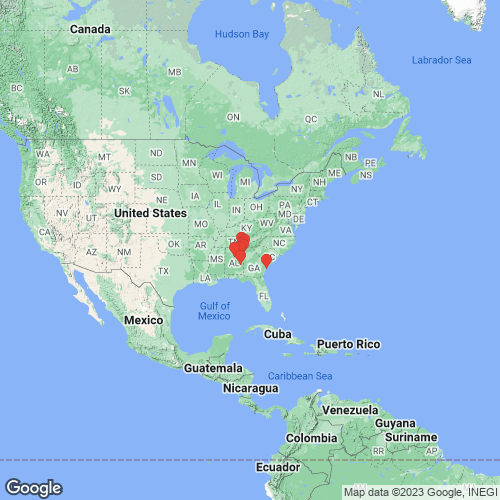
Range: Alabama River, USA. Map of Georeferenced Specimens
 |
Genbank Vouchers
USAUAUC_125 (COI, 16S, ND1) Etowah River, Shoal Ck, Pine Glen Recreation Area, Talladega NF, Cleburne Co. AL UAUC_650 (COI, 16S) USA, Georgia, Polk County, Etowah River, Fish Ck.,U.S. Hwy 278; GA St. Rt. 6, 3.9 air mi W Rockmart (34.03611, -85.05639) UAUC_248 (COI, 16S) UAUC_149 (COI, 16S) USA, Alabama, Jefferson County, Little Cahaba River, 0.5 mi below Cahaba Beach Rd. bridge (33.505, -86.620) UAUC_651 (COI, 16S) USA, Georgia, Murray County, Conasauga River, Tibbs Bridge on Tibbs Bridge Rd.; Murray CR 109 & Whittfield CR 100 (34.73667, -84.85722)
|