|
Bivalvia | Sphaerioida | Sphaerioidea | Sphaeriidae | Sphaeriinae | Conventus species Conventus ellisi (Dance, 1967): specimens
2 nominal species as synonyms
Taxonomic History (since 2007)
Pisidium (Afropisidium) ellisi — Nesemann et al. (2007), Gittenberger et al. (2018)
Pisidium (Afropisidium) chandanbariensis — Nesemann et al. (2007)
Pisidium ellisi — Bogan (2010), IUCN (2011), Bößneck et al. (2016), Clewing et al. (2020), Saito et al. (2022), Clewing et al. (2022)
Pisidium chandanbariensis — Bogan (2010), IUCN (2011)
Pisidium cf. ellisi — Bößneck et al. (2016), Clewing et al. (2020), Clewing et al. (2022), Saito et al. (2022)
Conventus ellisi — Bespalaya et al. (2023)
|
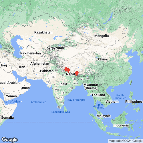
Range: Sikkim, India and Bhutan. Map of Georeferenced Specimens
 |
There are no specimens in the MUSSELpdb for this species.
Genbank Vouchers
NepalUGSB_11141 (NP10/1) (COI, 16S, 28S, H3) Nepal, Seti (near Lokanda) (29.66000°N, 81.35000°E) UGSB_10590 (NP15/1) (COI, 16S, 28S) Nepal, Karnali, Bheri Khola, limnocrene spring and source stream (near Kaigaon) (29.10717°N, 82.58867°E) UGSB_10572 (NP12/3) (COI, 16S, H3) Nepal, Mechi, Ghunsa Khola, spring (~2 km north of Sekathum) (27.55233°N, 87.83867°E) UGSB_17259 (NP18/1) (COI, 16S) Nepal, Seti, stream in the Khaptad National Park (~11 km southeast of Koiralakot) (29.39278°N, 81.13639°E) UGSB_10569 (NP14/1) (COI, 16S) Nepal, Karnali, source stream (near Pahada) (29.06667°N, 82.70000°E) UGSB_10596 (NP13/1) (COI, 16S) Nepal, Mechi, source stream (~1 km east of Taplejung) (27.35000°N, 87.66667°E) UGSB_10592 (NP16/1) (COI, 16S) Nepal, Karnali, source streams (near Rimi) (29.13400°N, 82.55900°E) UGSB_10587 (NP11/2) (COI, 16S) Nepal, Mechi, Omjee Khola, source stream (~200 m southwest of Omjee) (27.48333°N, 87.90833°E) UGSB_10586 (NP11/1) (COI, 16S) Nepal, Mechi, Omjee Khola, source stream (~200 m southwest of Omjee) (27.48333°N, 87.90833°E) UGSB_10588 (NP12/1) (COI, 16S) Nepal, Mechi, Ghunsa Khola, spring (~2 km north of Sekathum) (27.55233°N, 87.83867°E) UGSB_10589 (NP12/2) (COI, 16S) Nepal, Mechi, Ghunsa Khola, spring (~2 km north of Sekathum) (27.55233°N, 87.83867°E)
RMBH_MSph_399_1 (16S, 28S) RMBH_MSph_399_3 (16S) RMBH_MSph_399_2 (16S)
|