| Page last updated
Sun 07 Sep 2025 |
The Freshwater Mussels (Unionoida) of the World (and other less consequential bivalves)
FM(U)otW(aolcb) is the web version of the MUSSEL Project Database. Follow the links to browse the data or use the custom Google search field. Either way, you win!
This page reports the specimens in the MUSSELpdb and provides a map if geocodes are known. The taxonomic history reports the record of different names and combinations that have been applied to this species (and its synonyms) since 2007. The MUSSEL Project Database has moved to a new server, with a new URL! The new address for this page is: https://musselpdb.org/db.php?ty=validsp&id=4837
Search the database pages:
|
|
Unionoida | Unionoidea | Unionidae | Parreysiinae | Indochinellini | Indonaia species Indonaia bonneaudii (Eydoux, 1838): specimens
3 nominal species as synonyms
Taxonomic History (since 2007)
Parreysia (Radiatula) bonneaudi — Graf & Cummings (2007), Ramakrishna & Dey (2007)
Radiatula bonneaudi — Nesemann et al. (2007), Whelan et al. (2011)
Parreysia bonneaudi — Bogan (2010), IUCN (2010)
Radiatula bonneaudii — Pfeiffer & Graf (2015), Konopleva et al. (2017), Pfeiffer et al. (2018), Zieritz et al. (2018), Jeratthitikul et al. (2019), Ortiz-Sepulveda et al. (2020), Graf & Cummings (2021)
Radiatula cf. bonneaudii — Bolotov et al. (2017)
Radiatula cf. bonneaudii sp. 1 — Bolotov et al. (2017), Bolotov et al. (2018), Huang et al. (2019), Konopleva et al. (2019)
Radiatula khadakvaslaensis — Bolotov et al. (2017)
Indonaia (caerulea-group) bonneaudii — Bolotov et al. (2022), Bolotov et al. (2024)
Indonaia bonneaudii — Bolotov et al. (2022)
|
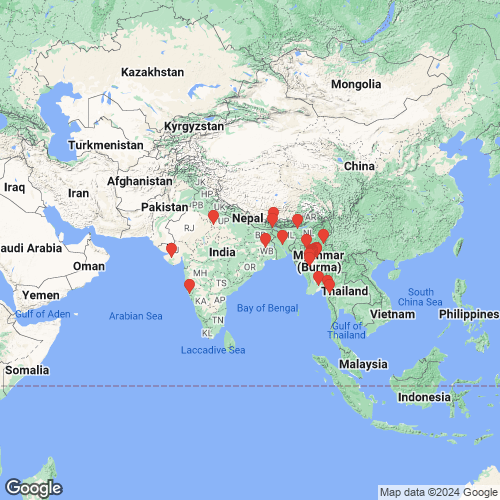
Range: Northern Myanmar and northeastern India, as well as Nepal. Map of Georeferenced Specimens
 |
India |

USNM_85348
India
|

BMNH_3185-03-7-1
Kattiawar [Prov. India]
|

BMNH_540-06-1-1
Damuda [Damodar] River, Bengal
|

BMNH_608-06-1-1
Damuda [Damodar] River, Bengal
|

USNM_250706
Bengal
|

BMNH_88-12-4-1682
Jumna [Yamuna] River
|

USNM_399735
British India
|

SMF_13519
Siliguri, Sikkim
|

SMF_13520
Indien
|

SMF_13524
Sikkim
|

UMMZ_109608
India
|

USNM_58106
Tespore [India?]
|
Myanmar |

BMNH_3187-03-7-1
Bhamo, Burma
|

MNHN_MP_2794
Inde Khamo [Myanmar]
|

USNM_126470
Bhamo, Upper Burmah
|

MNHN_MP_2797
Meetan, Houngdarau River, Birmanie
|

BMNH_410-06-1-1
Bhamo
|

UF_270741
Burma, Tenasserim
|

USNM_127037
Houngdaran Riv., Birmah
|

BMNH_467-06-1-1
Pegu
|

BMNH_496-06-1-1
Pegu
|

CAS_180789
BURMA [UNION OF MYANMAR]: Ayeyarwady River: Mandalay Division: Nyaung-U: river bank along sandstone cliffs, on rocks or buried in sand at shoreline, submerged 21.208567, 94.9259
|

CAS_180797
Ayeryarwaddy River, confluence Chindwin, SE corner.., Magway Division, Burma. 21.49844, 95.26631
|

UA_20714
Ayeryarwaddy River, Pakkoku, ferry landing, 1 to 5 m.., Magway Division. 21.31615, 95.06252
|

UA_20715
Ayeryarwaddy River, 3 mi SW Pakkoku, Magway Division. 21.2963, 95.01982
|

CAS_180800
Ayeryarwaddy River, across from Myint Gyant village.., Mandalay Division, Burma. 21.47327, 95.2973
|

CAS_180801
BURMA [UNION OF MYANMAR]: Ayeyarwady River: Sagaing Division: W shore of river SW of Mayogon village 21.81747, -95.4423
|

CAS_180802
Ayeryarwaddy River, confluence Chindwin, SE corner.., Magway Division, Burma. 21.49844, 95.26631
|

CAS_180803
BURMA [UNION OF MYANMAR]: Ayeyarwady River: Sagaing Division: Mingon: sandy island 0.78 mi N of Mingon 22.05815, 96.02353
|

CAS_180804
Chindwin River, Ma-U village, east side of river, Sagaing Division, Burma. 21.75477, 95.20013
|

BMNH_609-06-1-1
Bhamo, Upper Burma
|

BMNH_610-06-1-1
Pegu
|

CAS_180810
Ayeryarwaddy River, mud bank on E side of river, Mandalay Division, Burma. 21.48187, 95.30501
|

CAS_180811
BURMA [UNION OF MYANMAR]: Ayeyarwady River: Sagaing Division: across braided channel from Sin Ywa village 22.02174, 96.03226
|

CAS_180807
BURMA [UNION OF MYANMAR]: Ayeyarwady River: Sagaing Division: W shore of river SW of Mayogon village 21.81747, -95.4423
|

CAS_180808
BURMA [UNION OF MYANMAR]: Ayeyarwady River: Mandalay Division: Nyaung-U: river bank along sandstone cliffs, on rocks or buried in sand at shoreline, submerged 21.208567, 94.9259
|

CAS_180809
BURMA [UNION OF MYANMAR]: Ayeyarwady River: Sagaing Division: across braided channel from Sin Ywa village 22.02174, 96.03226
|

UA_20731
Ayeryarwaddy River, 1/2 mi SE Nyang-U, large sandbar, Mandalay Division, Burma. 21.2066, 94.90617
|

UA_20732
Chindwin River, Ma-U village, east side of river, Sagaing Division, Burma. 21.75477, 95.20013
|

UA_20734
Ayeryarwaddy River, confluence Chindwin, SE corner.., Magway Division, Burma. 21.49844, 95.26631
|

UA_20735
Chindwin River, sandbar to E side Yesagyo towns, Magway Division, Burma. 21.64268, 95.24423
|

UA_20736
Ayeryarwaddy River, mud bank on E side of river, Mandalay Division, Burma. 21.48187, 95.30501
|

UA_20737
Ayeryarwaddy River, confluence Chindwin, SE corner.., Magway Division, Burma. 21.49844, 95.26631
|

CAS_180836
BURMA [UNION OF MYANMAR]: Ayeyarwady River: Sagaing Division: Mingon: sandy island 0.78 mi N of Mingon 22.05815, 96.02353
|

CAS_180837
BURMA [UNION OF MYANMAR]: Ayeyarwady River: Mandalay Division: river bank and upper sandbar NE of Sagaing city 21.90265, 96.00702
|

CAS_180842
Ayeryarwaddy River, 3 mi SW Pakkoku, Magway Division. 21.2963, 95.01982
|

CAS_180853
BURMA [UNION OF MYANMAR]: Ayeyarwady River: Mandalay Division: sandbar across channel from Kyauk Ta Lon village on E side of river 21.91197, 95.77407
|

CAS_180857
BURMA [UNION OF MYANMAR]: Ayeyarwady River: Sagaing Division: across braided channel from Sin Ywa village 22.02174, 96.03226
|

CAS_180859
BURMA [UNION OF MYANMAR]: Ayeyarwady River: Sagaing Division: weir across tributary next to Mayogon village 21.81804, 95.4324
|

CAS_180861
BURMA [UNION OF MYANMAR]: Ayeyarwady River: Magway Division: large sandbar 1/2 mi SE of Nyaung-U 21.2066, 94.906183
|

SMF_168218
Birmah [Myanmar]
|

BMNH_88-12-4-1665
Bhamo
|

BMNH_88-12-4-1680-1681
Burmah
|

BMNH_MP_D373
Pegu
|

BMNH_MP_D377
Bhamo
|

BMNH_99-6-21-44-46
Chindwin River, near Matu
|

BMNH_99-6-21-47-53
Irawaddi, bei Yenengyoung
|

SMF_13522
Pegu
|

SMF_13523
Pegu
|

SMF_13525
Irawadi-Fl [Irrawaddy River], Birmah
|

SMF_13526
Birmah
|

BMNH_1906-5-9-6-7
Chindwin River
|

UMMZ_109609
Irrawadi [Irrawaddy], Burma
|

UMMZ_109610
Pegu, Burma
|

UMMZ_109611
Burma
|

UMMZ_109612
Burma
|
unknown |

BMNH_MP_D193
[locality illegible - Asia]
|
|
|
Genbank Vouchers
IndiaMp_3761_RNBI7 (COI) India: Karli River, 16.016°N, 73.695°E, Western Ghats, Maharashtra
|
Page updated: 08:24:01 Sun 07 Sep 2025 |
|